Goffs, California on Historic U.S. Route 66
 |
As it made its way westbound across California, Route 66 passed through Needles, Goffs, Fenner, Amboy, Ludlow, Newberry Springs, Barstow, Victorville, San Bernardino and into Santa Monica.
Leaving Needles, the road ventured a bit north, through Goffs. This railroad town remained a stop on Route 66 until 1931, when a more direct alignment between Needles and Essex was opened.
The road then headed south, through Chambless and Amboy, and then west to Ludlow, Newberry Springs and on to Barstow. There it turned south and traveled through Helendale, Victorville, through the Cajon Pass, and on to San Bernardino. A final westward track through Pasadena took the Mother Road to its final end, near Santa Monica.
In 1936 U.S. 66 was extended from downtown Los Angeles to U.S. 101, at Santa Monica. In 1940 the first freeway in Los Angeles was included as part of U.S. 66, the Arroyo Seco Parkway, later known as the Pasadena Freeway.
A popular stop on California Route 66 is the small community of Goffs.
Map showing the location of Goffs, California on Route 66 between Needles and Amboy

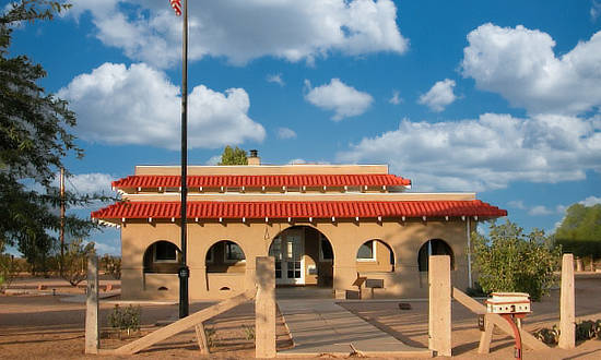
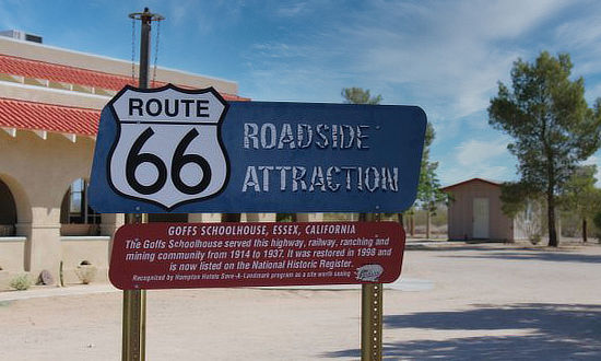
Goffs, CaliforniaGoffs, an unincorporated community about 40 miles west of Needles in San Bernardino County, California, is a nearly empty one-time railroad town at the route's high point in the Mojave Desert. Goffs was a stop on Historic U.S. Route 66, and jogged around the White Cottage Restaurant. In 1931 a more direct Route 66 alignment opened between Needles and Essex. A historic schoolhouse, built in 1914 and almost totally deteriorated by the early 1980s, has since been renovated to its original plans by the Mojave Desert Heritage and Cultural Association (MDHCA). The Goffs Schoolhouse is a one-room mission style desert school built by the County of San Bernardino to serve the growing population of the area. Through many of the 23 years it served as a school, dances were held in the building and it functioned as a branch of the county library and local community center. The schoolhouse and grounds now house a museum primarily specializing in the area's mining history. Remnants of Goffs's mining days still dot the town. The Dennis G. Casebier Library houses the Mojave Desert Archives. It is a replica of the historic Goffs Santa Fe Railway Depot (1902-1956). This climate-controlled repository was built in 2008 with funding from a California Cultural and Historical Endowment grant and donations from the membership of the MDHCA. Goffs today is accessible off Interstate 40 at U.S. Highway 95 north. A left turn onto Goffs Road, the pre-1931 alignment of US 66, becomes a desolate forty-mile stretch that served as home to several towns that have mostly vanished, including Bannock, Ibis, and Homer. Continuing west on Goffs Road brings motorists back to I-40 northeast of the town of Essex. Website of the Mojave Desert Heritage and Cultural Association and MDHCA on Facebook |
|
Entering Goffs, California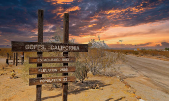 |
Dennis G. Casebier Library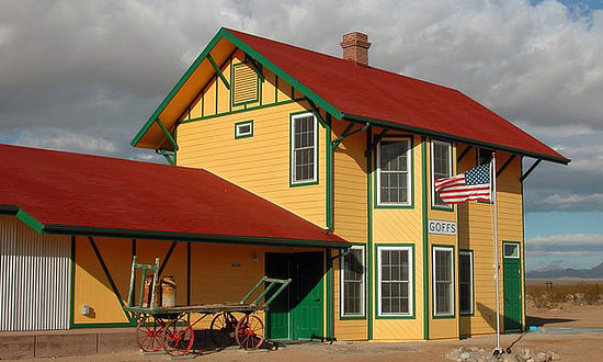 |
| Route 66 Roadside Attraction: The Old Schoolhouse |
|
 |
 |
Interactive Map of Goffs, California
MORE CALIFORNIA ROUTE 66 |
||
 |
 |
 |
 |
 |
 |
 |
 |
|
Travel Guides for Other States Along Route 66
Planning a Road Trip on Route 66? Here are trip planners for all eight states on The Mother Road ...
 |
 |
 |
 |
 |
 |
 |
 |
