Route 66 Trip Planning Guide for Albuquerque, New Mexico
Route 66 1926 Alignment
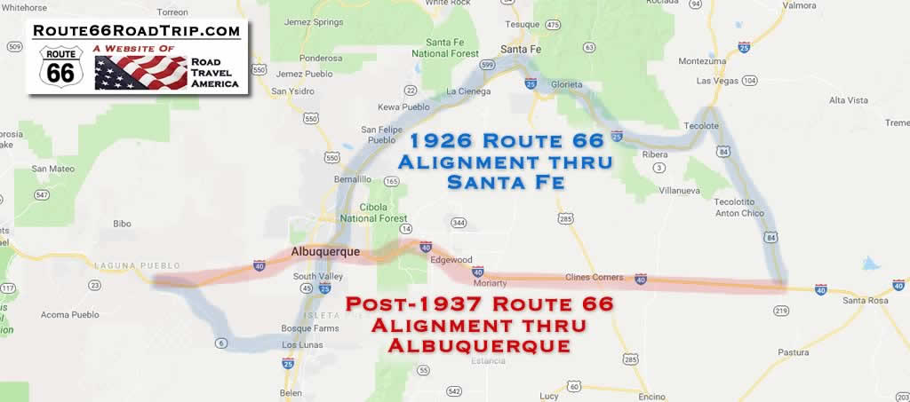
The original 1926 Route 66 alignment created a large "S Curve" in New Mexico as it headed north to Santa Fe through Tecolate, Bernai, San Jose, Pecos and Glorieta Pass, and then back south to Albuquerque.
The 1926 alignment came into Albuquerque from Santa Fe on Highway 313, and ran through downtown north-to-south along 4th Street. Today the Barelas-South Fourth Street Historic District just south of downtown is a popular attraction, with shops, restaurants and other businesses.
Route 66 then continued south to Los Lunas, where it turned west to Laguna.
Route 66 1937 Alignment
The 1926 alignment was replaced in 1937 with a more direct westward route into Albuquerque along Central Avenue, and then from Albuquerque directly to Laguna, and beyond to Gallup, following the current route of I-40 in many locales.
 |
With realignments and road improvements, the distance of Route 66 in New Mexico was reduced to 399 miles by 1937.
Dozens of motels, cafes, gift shops and restaurants spring up along the route in Albuquerque. Some of these vintage motels remain, and historic neon signs still glow on old Route 66 through Albuquerque, now Central Avenue.
Tourism, Attractions and the Route 66 Connections
Tourism is a big industry in Albuquerque, hosting large numbers of Route 66 travelers and events such as the International Balloon Fiesta.
Home to eclectic shops and unique restaurants, Route 66 in Albuquerque is adorned with buzzing neon signs, vintage artifacts, and epitomizes the unique ABQ attitude. Visitors can experience an authentic fusion of old and new along Route 66 in Nob Hill, the University area, Downtown, and Historic Old Town.
Central Avenue underwent several transformations that have molded it into the main Albuquerque street that it is today. Present-day Central Avenue connects locals and visitors to the city’s diverse neighborhoods, each offering unique and authentic Albuquerque experiences.
Old Town is the historic heart of Albuquerque, featuring San Felipe de Neri Church, the oldest building in the city, unique museums, and more than more than 100 stores and 24 galleries.
Downtown has gradually transformed into an arts and entertainment district with a variety of bars, restaurants, galleries, and live music venues, as well as new residential space. Here visitors will find bustling nightlife along Central Avenue (former Route 66), including many nightclubs, theaters and restaurants. The Albuquerque Convention Center is located downtown and is close to several major hotels.
Nob Hill is a vibrant district with eclectic shops, swanky dining and chic nightspots. Its Route 66 architecture and neon signs, combined with predominantly locally owned shops, galleries and restaurants, make Nob Hill a hip and fashionable area.
The city offers a variety of attractions and things to do for Route 66 travelers such as:
- Sandia Peak Tramway
- Indian Pueblo Cultural Center
- National Museum of Nuclear History
- San Felipe de Neri Church
- Albuquerque Old Town
- Petroglyph National Monument
- Anderson-Abruzzo International Balloon Museum
- ABQ BioPark Botanic Garden and Zoo
- New Mexico Museum of Natural History & Science
- Unser Racing Museum
- More Attractions & Things to Do in Albuquerque: TripAdvisor
Route 66 alignment in central New Mexico in 1926 and post-1937
Lodging & Dining Options in Albuquerque
|
Hotels in Albuquerque with Traveler Reviews Albuquerque Travel Guide |
| This website has no affiliation or connection with listed hotel and lodging properties. Listings from TripAdvisor and other media are provided as a starting point in your hotel research. It is always recommended that travelers do their own research and make informed decisions about the hotels they book. |
Enchanted Trails RV Park & Trading PostEnchanted Trails is located at 14305 Central Avenue NW in Albuquerque. Originally a trading post built in the 1940s, it has been the scene for several films and Route 66 videos. It features 135 sites to accommodate even larger size RVs. The Clubhouse is filled with vintages memorabilia, and the Trading Post has an impressive selection of Native American crafts, Southwestern foods, and fun items. Around the property is an excellent collection of vintage automobiles, recreational vehicles and travel trailers. For more information visit the website of the Enchanted Trails RV Park & Trading Post |
|
Enchanted Trails in Albuquerque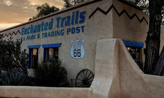 |
That sleek blue Hudson!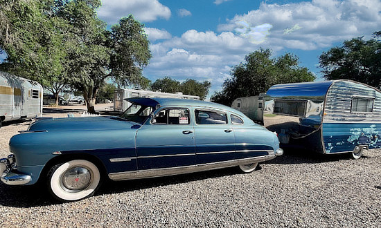 |
Best-Selling Route 66 Books and Maps at our Amazon Store |
|
| Route 66 Travel Guide - 202 Amazing Places by Mark Watson  |
Route 66 Full-throttle Adventure Handbook, by Drew Knowles  |
| EZ66 Guide for Travelers (5th Edition) by Jerry McClanahan  |
Rand McNally 2026 Road Atlas Large Scale Spiral Bound  |
About These ProductsThe Route 66 Road Trip website is a participant in the Amazon Services LLC Associates Program, an affiliate advertising program designed to provide a means for sites to earn fees by advertising and linking to Amazon.com and affiliated sites. Amazon offers a commission on products sold through their affiliate links. There is no additional cost to you. |
|
Route 66 Summerfest
This free event includes multiple stages full of local bands, food trucks, and more! This edition of the concert series takes over a mile-long stretch on Central Avenue from Girard Boulevard to Washington Street. Bring the family, enjoy the fun and celebrate Route 66. More Info: Website Date: July 18, 2026 |
Scenes Around Albuquerque
Anderson-Abruzzo International Balloon Museum in Albuquerque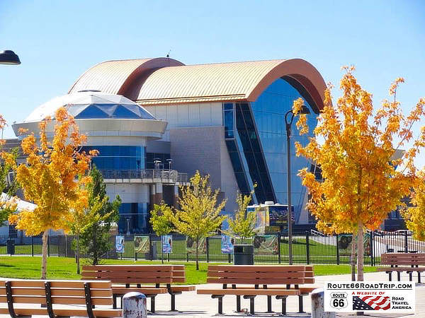 |
San Felipe de Neri Church in Albuquerque, New Mexico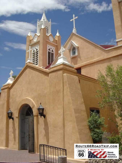 |
Downtown Architecture 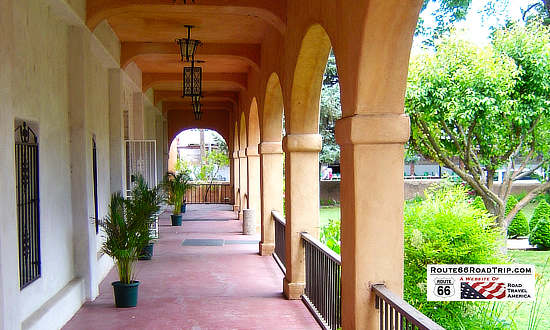 |
New Mexico Road & Recreation Atlas |
Sunset over Albuquerque 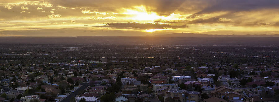 |
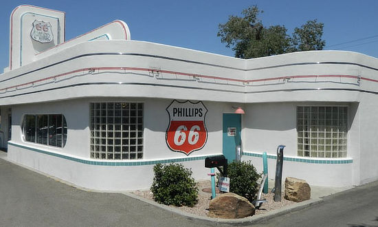
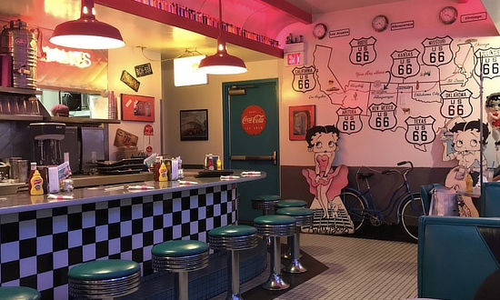
Route 66 DinerThe Route 66 Diner is a much-photographed, internationally known restaurant, a hit with locals and tourists alike! The Diner is located at 1405 Central Ave NE, Albuquerque, NM 87106 ... Phone 505.247.1421 For more information visit the website of the Route 66 Diner and TripAdvisor Reviews of the Route 66 Diner |
|
 |
 |
Lumberjack Man in AlbuquerqueThis giant lumberjack man holding an ax is located on the roof of the May Cafe in Albuquerque, New Mexico. The 27-foot tall giant sits atop a 20-foot tall platform. The cafe, which specializes in Vietnamese cuisine, is located at 111 Louisiana Boulevard SE, near the intersection with Central Avenue. Before housing the May Cafe, the building was the home of Shofner Lumber Company, who originally erected the lumberjack man. More information about the restaurant can be found at the May Cafe website
|
Albuquerque West Central Route 66 Visitor Center
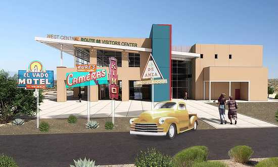 West Central Visitor Center rendering by Mullen Heller Architect West Central Visitor Center rendering by Mullen Heller Architect |
Bernalillo County and the City of Albuquerque are developing the 21,000sqft Route 66 Visitor Center to be located at 12200 Central Avenue, atop Nine Mile Hill, near Atrisco Vista and I-40.
It will capitalize on the historic nature of the U.S. Route 66 and encourage motorists to get off the interstate to learn all about the city's heritage with the old road.
The $12 million multi-use facility will also house the New Mexico Music Hall of Fame, a taproom, gift shop and be available for special events.
The outdoor market areas, including the parking lot, will be utilized for a makeshift drive-in theater, car shows, artisan pop ups, and other outdoor events.
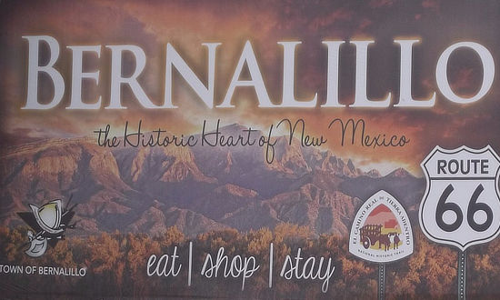
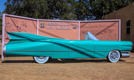
Nearby Bernalillo ... The Historic Heart of New MexicoThe 1950s Cadillac and Route 66 sign in Bernalillo, New Mexico, along the 1926 to 1937 Route 66 alignment between Santa Fe and Albuquerque ... near 241 S. Camino Del Pueblo in Bernalillo ... a great photo op! |
||
 |
 |
|
|
||
Interactive Map of Albuquerque, New Mexico
Earlier Times: Vintage Views along Route 66 in Albuquerque
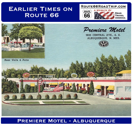
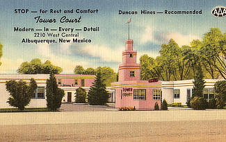
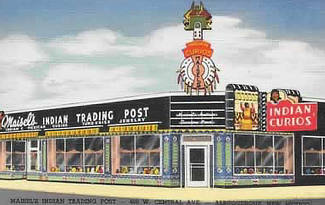
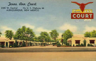
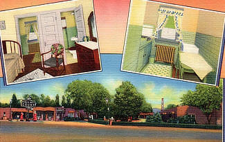
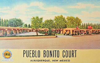
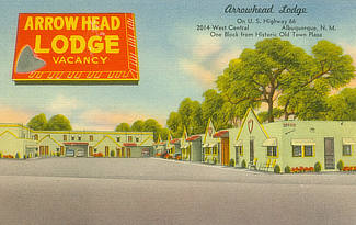
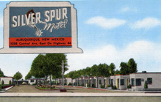
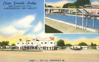
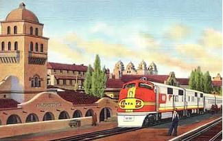
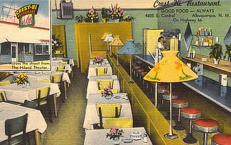
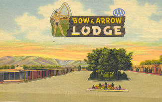
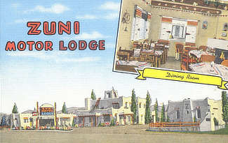
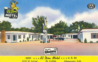
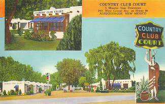
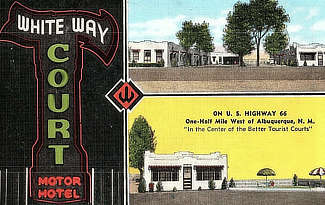
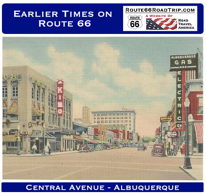
We have included below a sampling of our collection of vintage travel postcards dealing with Albuquerque and Route 66. What was Route 66 like in its earlier years, as visitors drove through and around Albuquerque? What did all the service stations, motels and public buildings look like when they were new? What did the traveling public experience on the Mother Road? We wonder such things when we travel Route 66 today. Those earlier times in the 1930s, 40s and 50s were not always captured on film. But the use of colorful postcards was common in those decades. These portray the historic road in its prime and help us to visualize, and appreciate, "earlier times" as we drive Route 66 today around Albuquerque.
|
A Day Trip from Albuquerque to Santa Fe Up La Bajada Hill
|
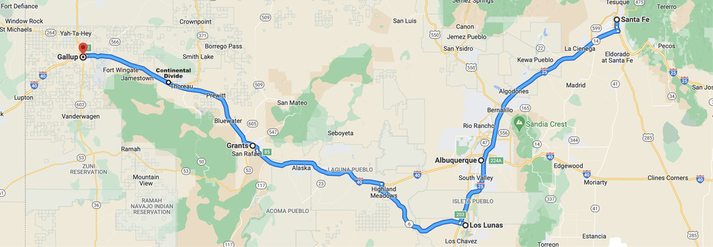
Today, the fastest route between Santa Fe and Albuquerque is I-25, a distance of about 65 miles. An alternate route is on the Turquoise Trail, Highway 14, through the quaint villages of Cerrillos and Madrid.
In earlier times Route 66 was the primary road northward to Santa Fe.
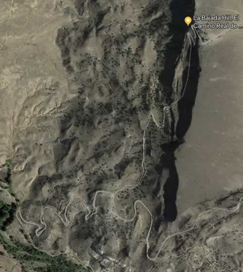
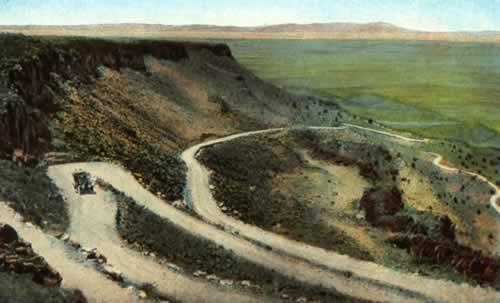
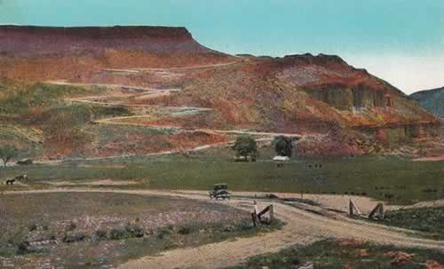
North of Albuquerque, Route 66 headed for Santa Fe and made the steep, 500-foot ascent up the La Bajada precipice in only two miles via a series of 26 switchbacks with a 28% grade.
Remnants of the swtichbacks and their scar on the earth can still be seen by hikers and those in high-clearance, 4-wheel drive vehicles, and from satellite photos like the one shown to the right.
In 1932 Route 66 was moved about three miles to the east near the current route of Interstate 25.
Read more about La Bajada Hill and El Camino Real at the NPS website
| Switchbacks on Route 66 at La Bajada Hill between Santa Fe and Albuquerque View from the top of the mesa looking south (left) and from the bottom looking north (right) |
|
 |
 |
The "Big Cut" on Route 66
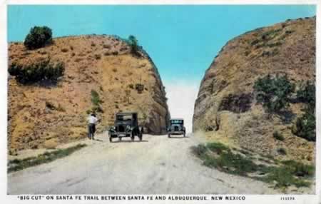 The Big Cut as seen in this early 1900s vintage postcard |
South of La Bajada between Santa Fe and Albuquerque was the "Big Cut". Located near the present-day San Felipe Pueblo, this was an engineering marvel when it was completed in 1909 as part of New Mexico's Route 1. Route 66 passed through the notch from 1926 to 1931.
It consisted of a 75-foot long, 60-foot deep cut in Gravel Hill in the foothills of the Sandia Mountains made by hard working construction workers with dynamite, picks and shovels. The 18-foot wide roadway was no longer used when Route 66 was realigned in 1931.
Remnants of the cut can still be seen from southbound I-25 at Exit 252 in back of the casinos on the east side of the interstate.
Map of Route 66 from Albuquerque to Santa Fe, New Mexico
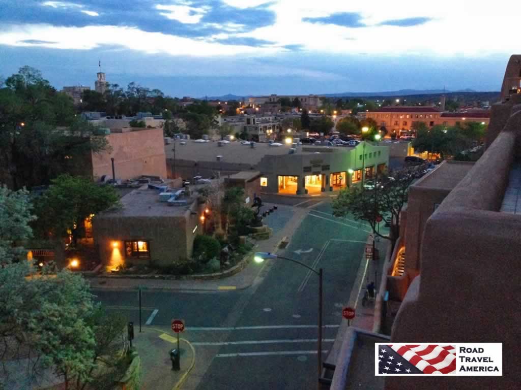
Nighttime view of Santa Fe and Old Route 66 looking west from La Fonda on the Plaza
MORE NEW MEXICO ROUTE 66 |
||
 |
 |
 |
 |
 |
 |
Travel Guides for Other Segments of Route 66
Planning a Road Trip on Route 66? Here are trip planners for the eight states along Route 66 ...
 |
 |
 |
 |
 |
 |
 |
 |
