Travel Route 66 from Tucumcari to Santa Fe
We've had the opportunity to get out on the road and explore Route 66 numerous times in Illinois, Missouri, Oklahoma, Texas, New Mexico, Arizona and California.
Highlights of This Route 66 Segment
 |
Included in this road trip are some of our favorite places and scenes along the Mother Road. This segment includes all of the best of Route 66, including drivable sections, ghost towns, classic motels and famous roadside attractions.
Heading westbound Route 66 in 1926 traveled through these places:
- Tucumcari ... quaint motels like the Blue Swallow and murals
- Cuervo ... another ghost town with many wooden buildings still standing
- Santa Rosa ... Route 66 Auto Museum and the Blue Hole
- Santa Fe, New Mexico
We have traveled this 1926 alignment multiple times over the years, both eastbound and westbound. Some of the journey is on I-40, which parallels the old Route 66 in most places. Where possible, we drive the segments of the Mother Road where it still remains. Exits to Route 66 from I-40 are marked in most locales.
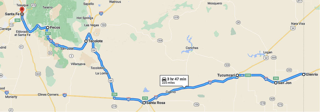
Map of the Route 66 1926 alignment from Glenrio to Santa Fe, New Mexico
Tucumcari Travel Highlights
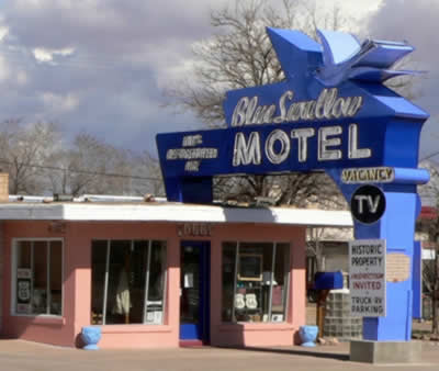 The Blue Swallow Motel, Tucumcari, New Mexico The Blue Swallow Motel, Tucumcari, New Mexico |
Leaving Glenrio, on the Texas-New Mexico border, we drive 42 miles and arrive at Tucumcari with its variety of vintage motels and electric neon signage. One of the more famous lodging properties here is the Blue Swallow Motel.
For many years, Tucumcari has been a popular stop for cross-country travelers on Interstate 40 and previously Route 66.
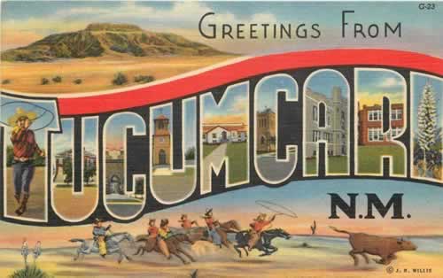
In the movie "Cars" the radiator-cap-shaped mountain marked “RS” (for Radiator Springs) was inspired by Tucumcari Mountain in New Mexico with its white “T.”
Today, in 2025, Old U.S. Route 66 runs through the heart of Tucumcari via Route 66 Boulevard. Numerous businesses, including gasoline service stations, restaurants and motels, were constructed to accommodate tourists as they traveled through on the Mother Road.
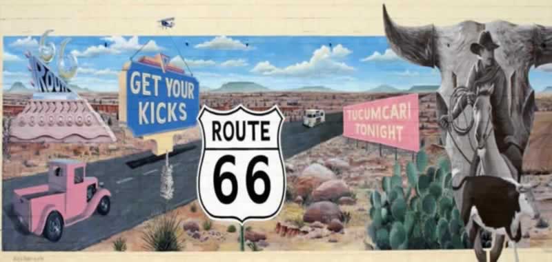
A large number of the vintage motels and restaurants built in the 1930s, 1940s, and 1950s are still in business. And Tucumcari is known for its murals painted on area buildings; more than twenty have been painted thus far.
|
Tucumcari hotels and traveler reviews at TripAdvisor Restaurant reviews at TripAdvisor Tucumcari Travel Guide and Things to Do |
|
The "Get Your Kicks on Route 66" mural in Tucumcari, New Mexico
Town of Cuervo
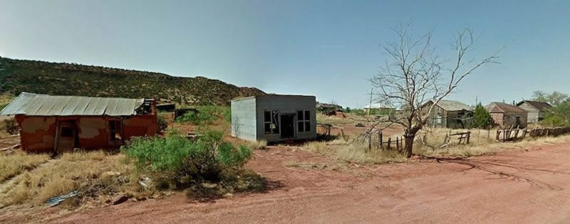
As we leave Tucumcari, we head west again, for 41 miles. Cuervo, New Mexico is an old Chicago, Rock Island and Gulf Railroad town that today is mostly abandoned, although some residents still live there.
The railroad siding was built in 1902 and named "Cuervo". The post office was opened that same year. Most of the town is on the south side of I-40, between the interstate and the hills to the south. A variety of old buildings, houses and churches survive today. A ghost town? Not quite, but close! Please respect private property.
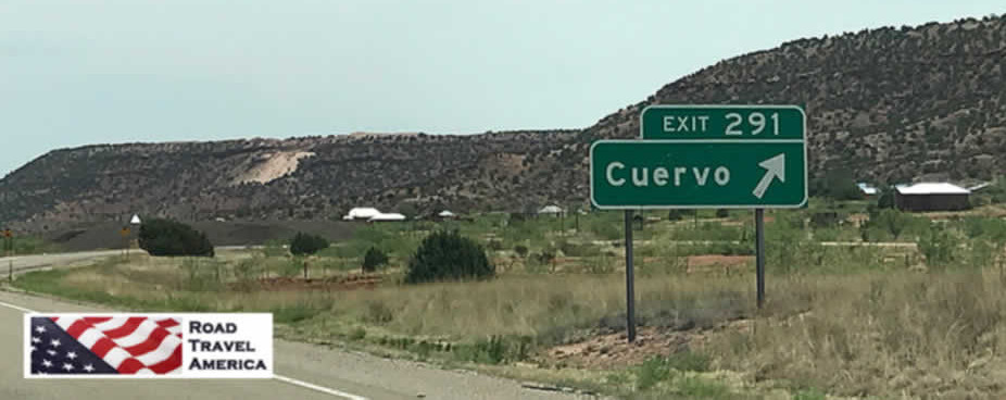
Exit 291 from I-40 to Cuervo, New Mexico
Scene from present-day Cuervo, New Mexico
A Stopover in Santa Rosa
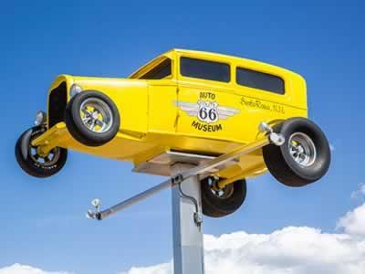 Route 66 Auto Museum, Santa Rosa, New Mexico Route 66 Auto Museum, Santa Rosa, New Mexico |
Only 18 more miles and we find ourselves in Santa Rosa.
When Route 66 passed through Santa Rosa in 1930, numerous service stations, cafés and motor courts were built to accommodate motorists traveling the Mother Road.
Today, visitors still see an assortment of buildings and signs that take one back to those glory days of Historic Route 66 in Santa Rosa.
One of the popular local attractions is the Route 66 Auto Museum, which draws car buffs from all over the country and beyond. The museum houses a large collection of classics, low riders, muscle cars and motorcycles … plus, gas pumps and other auto memorabilia from the early days of Route 66.
 Click to read more about Route 66 in Santa Rosa |
Nearby Santa Rosa Lake State Park is the place to be for camping, boating, water skiing, jet skiing, swimming, hiking, biking and so much more!
The world famous Blue Hole offers all sorts of water-based sports, including diving, swimming, snorkeling and scuba diving.
Santa Rosa offers a variety of hotels, inns, RV parks and campsites for visitors to the area.
Two Route 66 Alignments to Follow Leaving Santa Rosa
As one leaves Santa Rosa today heading west, there are two options to follow:
- The 1926 alignment through Santa Fe to Albuquerque
- The post-1937 alignment through Clines Corners and Moriarty, all on I-40, then on old 66 west of Moriarty and Tijeras Canyon to Albuquerque
Approximately 507 miles long in 1926, the alignment of Route 66 in New Mexico was reduced to 399 miles by 1938, bypassing Santa Fe.
The longest sections of the initial alignment created a large "S curve" as the road stretched across the middle of the state, as shown in the map below.
Route 66 alignment in central New Mexico in 1926 and post-1937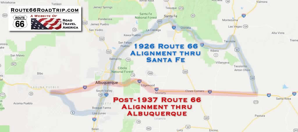 |
Following the 1926 Route 66 Alignment through Santa Fe
Leaving downtown Santa Rosa, Route 66 crossed the Pecos River, headed west for 17 miles, and then turned to the north. It passed through Dilia, Apache Springs and Los Montoyas on its way to Romeroville, roughly along present-day U.S. 84.
If travelers want, they can take a quick 6-mile side-trip from Romeroville northeast up to the historic city of Las Vegas, New Mexico, established in 1835.
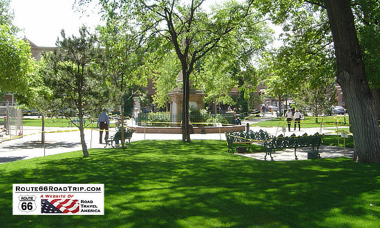 The historic plaza, Santa Fe, New Mexico The historic plaza, Santa Fe, New Mexico |
From Romeroville, Route 66 followed the corridor of the old Santa Fe Trail and the Santa Fe Railway, and passed through the villages of Tecolote, Bernal, San Jose, the railroad town of Rowe and Pecos.
The Santa Fe Trail was a 19th-century transportation route through central North America that connected Independence, Missouri with Santa Fe. It served as a vital commercial highway until the introduction of the railroad to Santa Fe in 1880.
Past San Jose, the Mother Road assumed an alignment roughly parallel to the railroad tracks, and climbed the 7,500 foot Glorieta Pass. At Cañoncito, the railroad diverged from the highway and continued on to Lamy.
Arriving in Santa Fe
Once in Santa Fe, Route 66 passed through the heart of downtown, along side the historic LaFonda on the Plaza Hotel. Santa Fe was also near the end of the El Camino Real de Tierra Adentro which carried trade from Mexico City.
Santa Fe remained on the original Route 66 until 1938 when the road was rerouted on a more direct alignment thru Clines Corners to Albuquerque.
Today, Santa Fe is located on Interstate Highway 25, about 65 miles northeast of Albuquerque. U.S. Highway 285 traverses the city in a north-south orientation. Santa Fe is the capitol city of New Mexico, and is positioned at 7,000 feet above sea level.
Things to Do in the Santa Fe Area
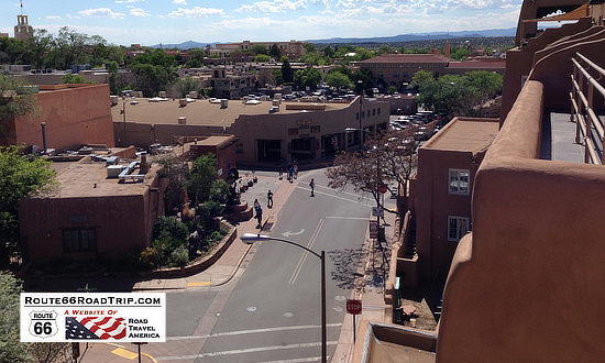 Historic Route 66 in Santa Fe |
The Plaza, the epicenter of downtown Santa Fe, and the Palace of the Governors, the oldest continuously occupied government building in the United States, were built in 1609 and 1610, respectively. Native American artisans from New Mexico's 22 pueblos and tribes still sell jewelry beneath the Palace’s long portal, as they have for hundreds of years.
The Cathedral Basilica of St. Francis of Assisi is a dominant landmark in the downtown area, and a must-not-miss attraction for visitors.
Nearby things to see include Loretto Chapel, the New Mexico State Capitol building, and the New Mexico Museum of Art.
A popular stop for residents and visitors alike is the Santa Fe Opera, just north of the city. Be sure to also explore the artistic Canyon Road, the Midtown Innovation District, the vibrant Southside and the hip Railyard-Guadalupe district.
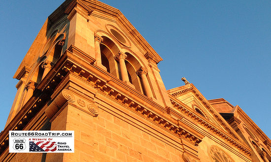 A must-see attraction in downtown Santa Fe ... the Cathedral Basilica of St. Francis of Assisi |
On Upper Canyon Road, the Randall Davey Audubon Center and the Nature Conservancy’s Santa Fe Canyon Preserve span 325 acres that rise through four eco-zones, from brushy cottonwood and willow to Ponderosa pine forest.
Museum Hill features four of the finest destinations in the area, including the Museum of Indian Arts & Culture, Museum of Spanish Colonial Art, Museum of International Folk Art and the Wheelwright Museum of the American Indian.
Just a short drive up the mountain, Ski Santa Fe features seven lifts, 74 trails, a snowsports school and a children’s center. With one of the highest elevations in the country, Ski Santa Fe is also popular with snowboarders.
Lodging Options in the Santa Fe Area
Lodging options in Santa Fe are plentiful. There are over 60 hotels, 35 bed & breakfasts, 23 units of specialty lodging, spas, and dozens of vacation rentals to meet any travel need and desire.
 |
During our many trips to Santa Fe over the years, we have stayed at the historic El Rey Inn located at 1862 Cerrillos Road. It was built in 1936 on Historic Route 66, and remains today an icon in Santa Fe. It features 86 unique rooms and suites, each individually decorated.
We have also stayed multiple times at La Fonda on the Plaza, located next to the Plaza and the Cathedral, at 100 East San Francisco Street. The suite by the Bell Tower on the top floor is highly recommended, with spacious rooms and panoramic views of the downtown area. Parking is available in the covered, gated La Fonda Parking Garage.
Every trip to Santa Fe includes at least one dining experience at the La Plazuela restaurant in the hotel. Be sure to ask for guacamole to be custom made at your table! And after a day sightseeing, we always stop at the La Fiesta lounge for cold margaritas and snacks; it is adjacent to the lobby on the first floor.
Another lodging choice about two blocks from the Plaza is the Inn on the Alameda. It offers various rooms, suites and casitas located in easy walking distance to downtown. Located at 303 East Alameda. Free parking.
If you are staying north of Santa Fe, and also visiting Taos, one option is the Abiquiu Inn.
|
View all hotels in Santa Fe, read traveler reviews and make reservations
|
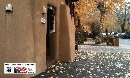 Inn Inn on the Alameda Inn Inn on the Alameda |
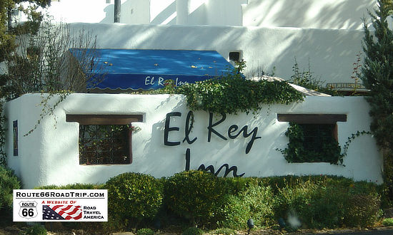 The El Rey Inn The El Rey Inn |
The Post-1937 Alignment Through Clines Corners & Moriarty
The post-1937 Route 66 alignment cut about one hundred miles off the previous, 1926 alignment through Santa Fe. The road stretched west from Santa Rosa, and climbed over 2,400 feet by the time it arrived at Clines Corner.
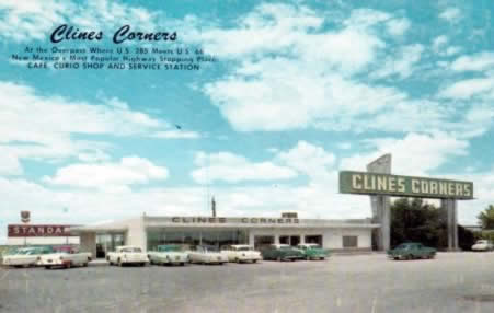 Early view of Clines Corners in New Mexico Early view of Clines Corners in New Mexico |
Roy Cline opened his rest stop in 1934 at the intersection of what was then New Mexico State Highways 6 and 2.
For decades since, travelers have stopped at Clines Corners Travel Center for a needed break, fuel, or just their homemade fudge. Today, Clines Corners Retail Center spans over 30,000 square feet.
It is located at the intersection of I-40 and U.S. 285, 68 miles east of Albuquerque, at Exit 218. It offers gasoline, a restaurant, souvenirs and gift shop, large clean restrooms, RV park, and more! It's always worth a stop. The official address is 1 Yacht Club Drive, Clines Corners, NM, 87070. Phone: 575.472.5488, or visit the Clines Corners website
From Clines Corners, Route 66 continued west, through Moriarty, Edgewood, Tijeras, and into Albuquerque. A popular side trip from Tijeras is the Turquoise Trail.
Best-Selling Route 66 Books and Maps at our Amazon Store |
|
| Route 66 Travel Guide - 202 Amazing Places by Mark Watson 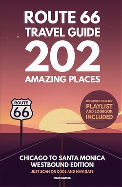 |
Route 66 Full-throttle Adventure Handbook, by Drew Knowles 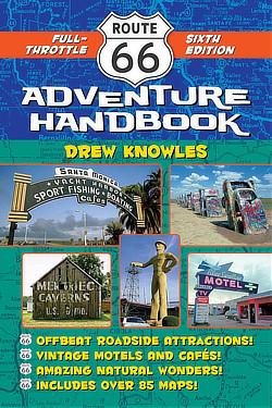 |
| EZ66 Guide for Travelers (5th Edition) by Jerry McClanahan  |
Rand McNally 2026 Road Atlas Large Scale Spiral Bound  |
About These ProductsThe Route 66 Road Trip website is a participant in the Amazon Services LLC Associates Program, an affiliate advertising program designed to provide a means for sites to earn fees by advertising and linking to Amazon.com and affiliated sites. Amazon offers a commission on products sold through their affiliate links. There is no additional cost to you. |
|
MORE NEW MEXICO ROUTE 66 |
||
 |
 |
 |
 |
 |
 |
Travel Guides for Other States Along Route 66
Planning a Road Trip on Route 66? Here are trip planners for the major segments ...
 |
|||
 |
 |
 |
 |
 |
 |
 |
 |
