Route 66 from Kingman to Topock in Arizona
Two Route 66 Alignments:
- 1926 Alignment - The original Route 66 alignment in 1926 ran southwest from Kingman through Cool Springs to Oatman, and onward to Golden Shores and Topock where it turned west to Needles, California. This alignment was selected over the route through Yucca due to the thriving mining industry at that time in Oatman.
-
1952 Alignment - The Route 66 alignment was changed in 1952, running from Kingman through the small town of Yucca and then to Topock and into California. This alignment is essentially the same as present-day I-40 from Kingman to the Colorado River at California.Read more about the 1952 Route 66 Alignment from Kingman to Topock
Starting This Road Trip in Kingman Arizona
The City of Kingman is the county seat of Mohave County, and has a population of about 28,000 residents, while the entire metro area accounts for about 66,000 residents. Kingman is located on Historic Route 66, Interstate 40, U.S. Route 93, and Arizona Highway 68. With its geographical location, it provides access to the gambling destinations of Las Vegas and Laughlin, Nevada, as well as the Grand Canyon, California, the Colorado River, Lake Mead National Recreation Area, Lake Mohave, and Lake Havasu. It also is an Amtrak stop.
Popular attractions include the Historic Route 66 Museum and the Kingman Railroad Museum. For aviation fans, be sure to make a stop at the Kingman Airport on the north side of town. It is a major airplane boneyard and storage facility for commercial airliners.
The Kingman area is served by about 35 hotels and motels, and over 100 restaurants, diners and cafes.
Welcome to Historic Downtown Kingman, Arizona ... the Heart of Route 66 |
Lodging Options in Kingman, Arizona
|
Read traveler reviews and see photos on 40 hotels in Kingman |
Driving the 1926 Alignment from Kingman to Oatman and Topock
The Route 66 (Highway 10, Oatman Highway) stretch from Kingman to Oatman starts out flat and fairly straight. Later the road features numerous switchbacks, but is paved, albeit a bit narrow.
In the early years, this road was a challenge to navigate. However, today, anyone with even moderate mountain driving experience shouldn't have any problems. Travelers with long trailers should make driving decisions accordingly. Sitgreaves Pass, elevation 3,550 feet, lies between Cool Springs and Oatman.
Read more about the Historic Route 66 National Back Country Byway (BLM) ... it begins five miles south of Kingman at the McConnico exit off Interstate 40. To begin at the southern end, exit off Interstate 40 at the Topock/Golden Shores.
Map showing the 1926 U.S. Route 66 alignment from Kingman to Oatman and Topock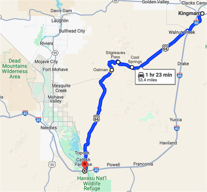 |
Only 23 more miles through Mohave County to Oatman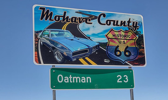 |
Route 66 travel kiosk between Kingman and Oatman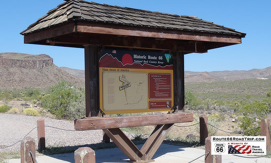 |
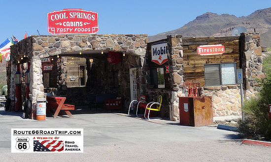
Cool Springs ... cabins, tasty foods, gift shop and museum ... between Kingman and Oatman.
For more Cool Springs information, history, museum gifts and more, visit
www.Route66CoolSpringsAz.com and Cool Springs on Facebook
| Sitgreaves Pass on Route 66, elevation 3,550 feet, between Cool Springs and Oatman, Arizona 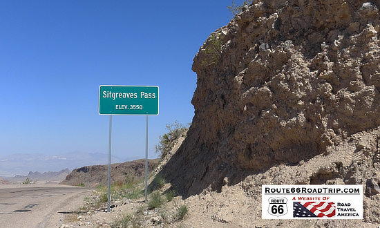 |
Sign in Oatman - I survived the Arizona Sidewinder: 191 turns, 8 miles of Historic Route 66, no guardrails! 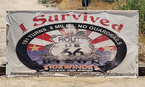 |
Oatman, Arizona
The Drulin Hotel, built in 1902, did a brisk business to the area miners. This old hotel, renamed the Oatman Hotel in the 1960s, is the only historic two story adobe building in Mohave County. In 1930, it was estimated that 36 million dollars worth of gold had been mined around Oatman. The town boasted two banks, seven hotels, twenty saloons and ten stores. There were over 10,000 people living in Oatman area.
Today, the popular small town of Oatman is an interesting stop, with numerous gift shops and small restaurants. It is located at elevation 2,700 feet. Oatman's famous "Wild" Burros that wander the streets are the descendants of burros brought here by the miners, and when no longer needed were turned loose.
The original 1926 alignment of Route 66 then turned to the southwest from Oatman on its way to Topock and Needles, California.
The Ore House in Oatman, AZ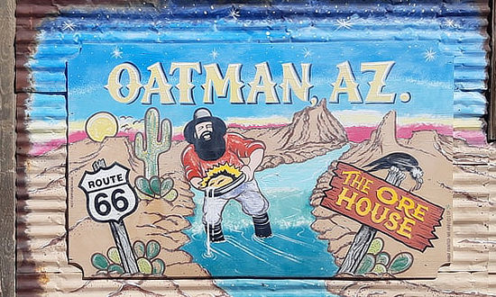 |
Wild burros at the Oatman Hotel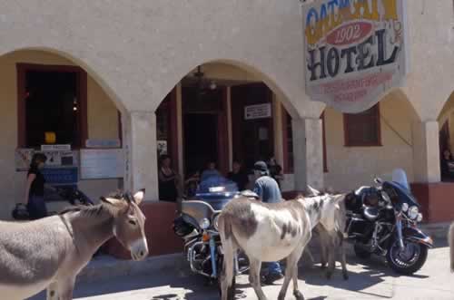 |
Lodging Options Nearby Oatman
|
Hotels in Bullhead City, Arizona |
The 1952 Route 66 Alignment from Kingman to Topock
In October of 1952, the Route 66 alignment was changed, starting in Kingman, passing through the small community of Yucca, and then into Topock. This alignment roughly paralleled the railroad and by-passed Oatman, providing westbound travelers a safer and faster trip to California. The new route resulted in growth in Yucca, with new service stations, a Whiting Brothers' truck stop, cafes, motels and other businesses opening along the new highway. This alignment is essentially the same as present-day I-40 from Kingman to the Colorado River at California.
Yucca, Arizona
Yucca dates back to the 1880s when it was a water stop for steam engines on the Atlantic and Pacific Railroad. The town of Yucca is located 24 miles southwest of Kingman, and 38 miles east of Needles, California.
Winters are mild, typically with no snow, but summers are harsh, with temperatures frequently in the 110 degree range.
The Army Air Force Flexible Gunnery School, Kingman, Arizona, was built in 1942 at the start of World War II as an aerial gunnery training base, located on approximately 4,145 acres in Mohave County next to U.S. Route 66. Arizona was an ideal location due to its sparse low population and miles of wide open spaces. It offered its first classes in January of 1943, and was renamed Kingman Army Air Field (KAAF) later that year with the primary mission of training gunners for the B-17 Flying Fortress. An auxiliary base was established at Yucca. In June of 1955 the base would be turned into the Ford Motor Company's Arizona Proving Grounds; the facility still exists today, owned by the Chrysler Corporation.
In the 1960s, the Parker Dam was built near Yucca, creating Lake Havasu. When I-40 was opened through the area, it followed the 1952 Route 66 alignment.
The population today is about 100 residents. The community includes a couple of truck stops (Pride Travel Center and the Flying J Travel Center), a post office, and school. A former residence inside a large geodesic dome has been developed into "Area 66", a UFO attraction which is currently temporarily closed. Another popular photo-op is the "truck on a pole". The Haviland Rest Area is located just south of Yucca.
Map showing the 1952 U.S. Route 66 alignment from Kingman to Yucca and Topock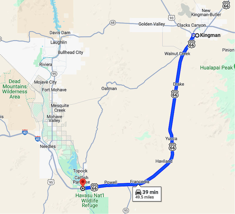 |
Scenes Around Yucca
Arizona Proving Ground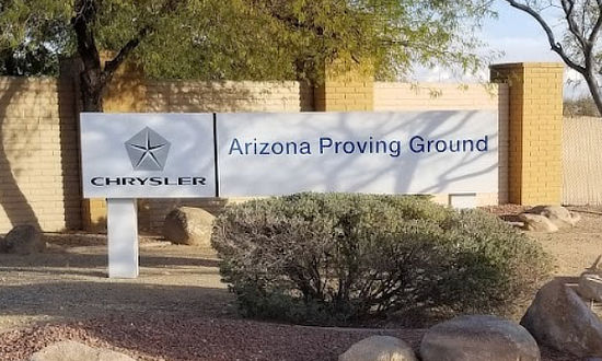 |
Area 66 in Yucca, Arizona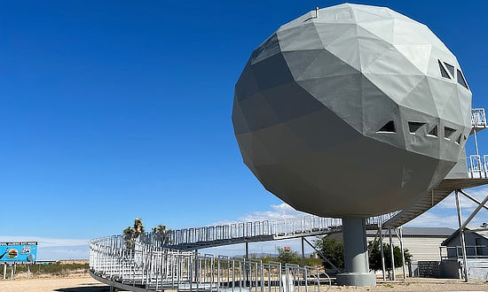 |
Truck on a Pole in Yucca, AZ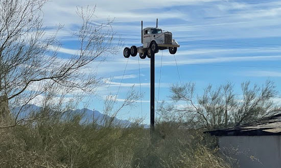 |
Pride Travel Center in Yucca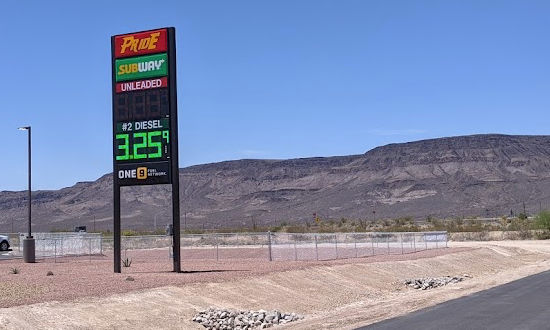 |
|
||||||||||||
Travel Guides for Other States Along Route 66
Planning a Road Trip on Route 66? Here are trip planners for all eight states on The Mother Road ...
 |
 |
 |
 |
 |
 |
 |
 |
Popular Side Trips Near Route 66 |
|||
 |
 |
 |
 |
