The Bridges of Route 66
U.S. Route 66 was one of the United State's first paved stretches of continuous highway, and served as a major path for those migrating west.
Beginning in Chicago, Route 66 headed southwest through Illinois and Missouri, and a small section of southeast Kansas. The highway then turned more westward through Oklahoma and Texas, with the final stretches in New Mexico and Arizona before its termination point in Los Angeles.
In order to make the 2,448 miles (3,940 kilometers) of Route 66 a reality, design and construction of hundreds of bridges was undertaken. Some bridges were large and significant, like those over the Mississippi River, others were smaller to cross streams, other highways, and railroad tracks.
On this page we highlight some of the more well known historic bridges along the Mother Road.
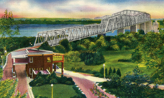
The Old Chain of Rocks BridgeThe historic Chain of Rocks Bridge spanning the Mississippi River on the north edge of St. Louis, Missouri was opened in 1929. The eastern end of the bridge is on Chouteau Island, (part of Madison, Illinois), while the western end is on the Missouri shoreline. The bridge was part of U.S. Route 66 and linked two states: Illinois and Missouri. The bridge is short and narrow, only 1 mile long by 24 feet wide. It towers more than 60 feet above the water, and features a unique 30-degree turn midway across the river. Construction cost of the bridge was over $2.5 million, twice its original estimate. The bridge had beautifully landscaped approaches. A park-like setting around a pool and a large, ornate toll booth anchored the Missouri end. On the Illinois side, 400 elm trees lined the approach. The bridge brought travelers into St. Louis by way of the picturesque Chain of Rocks amusement park on the Missouri hills overlooking the river. The bridge became an official part of the Route 66 system in 1936, when the Mother Road was rerouted over the bridge. In 1966, the New Chain of Rocks Bridge was built immediately to the old bridge's north in order to carry I-270; the old Chain of Rocks Bridge was closed in February of 1970. The bridge is currently open daily for pedestrians and biking; permits are required for automobile traffic for special events. Current status, parking information and alerts about the bridge at the Great Rivers Greenway website Vintage view of the Chain of Rocks Bridge |
|
Bridge entrance in Illinois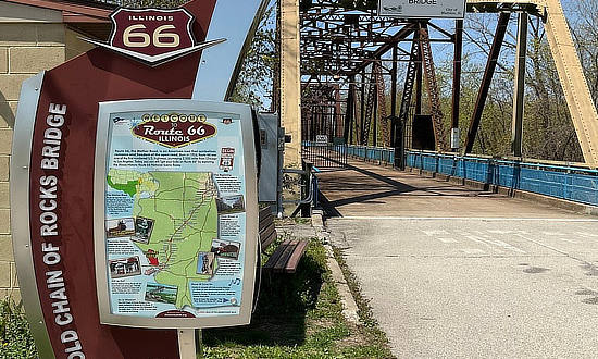 |
Old Route 66 signs on the bridge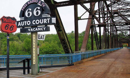 |
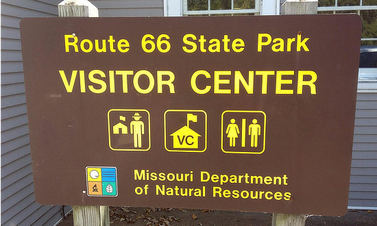
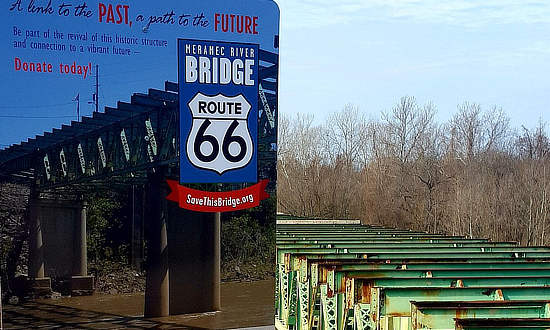
Route 66 Meramec River BridgeTravel through history on The Mother Road at Route 66 State Park, near metro St. Louis. The park's visitor center is the former Bridgehead Inn, a 1935 roadhouse that sat on the original Route 66. Picnic sites and trails are located throughout the park. Efforts are now underway to fund the restoration of the park's historic 1,000 foot long Route 66 Meramec River Bridge completed in 1932. For more information, visit the SaveThisBridge.org website. |
|
 |
 |
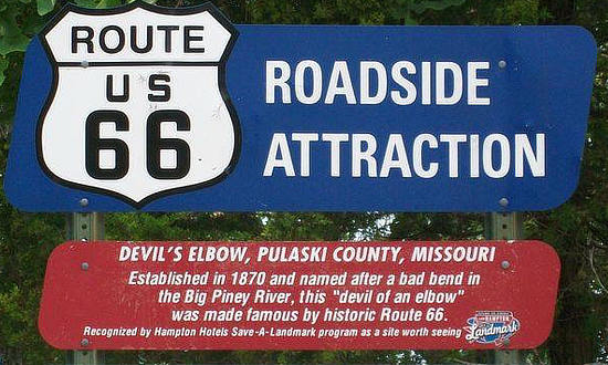
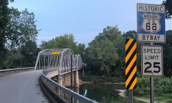
Devils Elbow BridgeEstablished in 1870 and named after a bad bend in the Big Piney River, this "devil of an elbow" in Pulaski County was made famous by Historic Route 66. This small community is located on the old 1926 to 1943 Route 66 alignment. Missouri State Highway 14, later Route 66, brought new visitors in automobiles to discover the idyllic beauty of Devils Elbow. The iconic steel bridge was constructed as a Highway 14 improvement in 1923. The bridge was refurbished in 2013 and re-opened to traffic May 2014. Today, Devils Elbow, an unincorporated community, is on many Route 66 bucket lists of must-see locations along the Mother Road. Travelers and tourists stop to admire and photograph the famous bridge and Elbow Inn. |
|
 |
 |
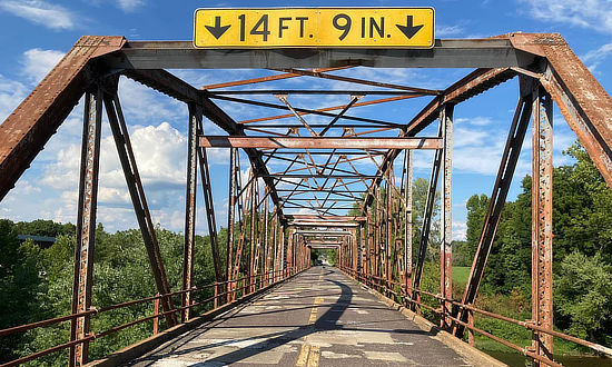
Gasconade River BridgeThis historic Route 66 bridge is located about 15 miles west of Waynesville, near Hazelgreen, Missouri. It was built circa 1923, and remains intact, but was permanently closed to traffic in 2014, pending restoration as a pedestrian bridge. In 2019, a 750-foot bridge was built between I-44 and the historic bridge. This new bridge allows Route 66 travelers to continue their Mother Road journey, without having to exit and travel on I-44 for a distance. It enables drivers to experience about another eight miles of Missouri Route 66.
|
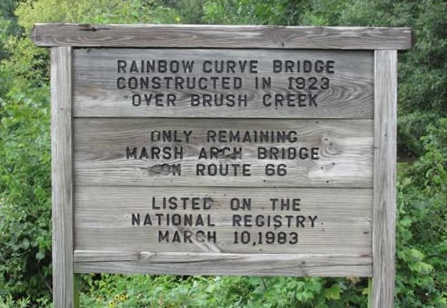
Rainbow Curve Bridge
|
|
Welcome to historic Baxter Springs, KS, site of the Rainbow Bridge on Old Route 66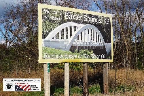 |
|
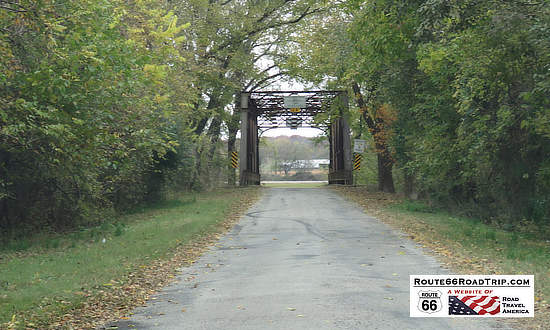
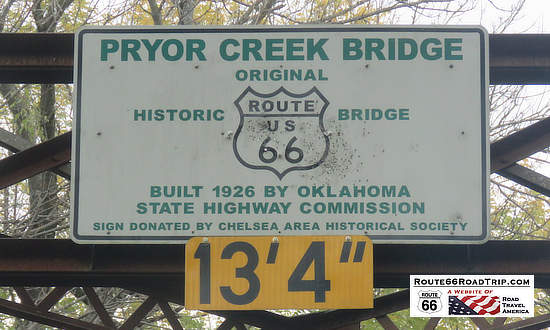
Pryor Creek BridgeThe historic Pryor Creek Bridge was built in 1926 and carried U.S. Highway 66 traffic from then to 1932, when a new alignment bypassed the bridge. It is of "Modified Pratt Through Truss" design,123 feet long and 19 feet wide. Located near Chelsea, Oklahoma, it was added to the National Register of Historic Places in 2006. |
|
 |
 |
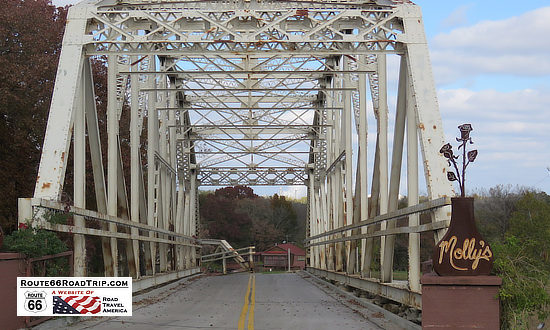
Tom Kight BridgeThe relocated circa 1936 Tom Kight Bridge, just north of Catoosa, Oklahoma, heading into Molly's Landing Restaurant |
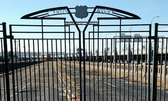
Route 66 Bridge over the Arkansas RiverDirectly west of the Cyrus Avery Centennial Plaza in Tulsa is the original Eleventh Street Bridge bridge built in 1915 to carry Route 66 over the Arkansas River. It is located between newer bridges on Southwest Boulevard and Interstate 244, and was closed to traffic in 1980 although it remained open for pedestrians for a time. Gates were locked on the bridge in 2008, and it remains closed to both vehicular and pedestrian traffic today. The old bridge is listed on the National Register of Historic Places and re-named the Cyrus Avery Route 66 Memorial Bridge. |
|
 |
 |
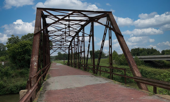
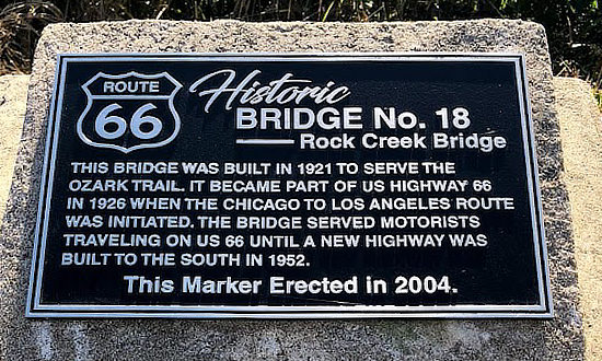
Rock Creek Bridge No.18This bridge was built in 1921 to serve the Ozark Trail. It became part of U.S. Highway 66 in 1926 when the Chicago to Los Angeles route was initiated. The bridge served motorists traveling on U.S. 66 until a new highway was built to the south in 1952. It is located near the junction of U.S. 66 and W. Ozark Trail in Sapulpa, Oklahoma, just west of the city. Read more about the Rock Creek Bridge at NPS
|
||
 |
 |
|
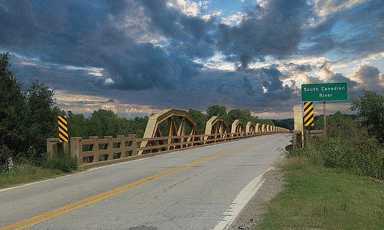
The Pony Bridge ... On Historic U.S. Route 66This well known bridge on Old Route 66 over the South Canadian River is located near Bridgeport, OK, between El Reno and Hydro. Built in 1934, it remains the longest truss bridge in Oklahoma and the entire Mother Road route. The 38-span pony truss bridge is 3,944 feet in length, and officially named the William H. Murray Bridge. Pony trusses are bridge trusses that don’t connect at the top. The bridge, on the National Register of Historic Places was closed beginning in 2022 for a two year reconstruction. The bridge was widened to current standards, and the trusses reinstalled along the sides to retain its historical value. It was reopened in May of 2024.
|
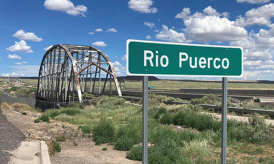
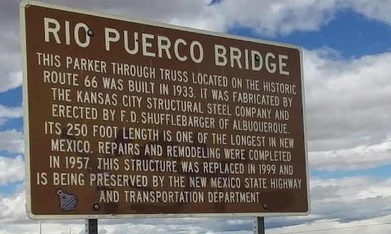
Rio Puerco BridgeThe Rio Puerco Bridge, located on Historic Route 66 just west of Albuquerque, was built in 1933. Its 250-foot length made it one of the longest bridges in New Mexico. It was replaced in 1999 and is being preserved by the New Mexico State Highway and Transportation Department. |
|
 |
 |
 |
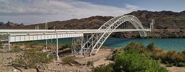
Old Trails BridgeFrom the day it opened in 1914 near Topock, this graceful bridge was an important Colorado River crossing, first on the transcontinental National Old Trails Road and by 1926 on Route 66. The Old Trails Bridge carried traffic until 1948 when cars and trucks began moving onto Interstate highways. In 1948, the deck was removed to allow the bridge to accommodate a natural gas pipeline, which it still carries. The bridge was listed in the National Register of Historic Places in 1988. It is located several hundred feet south of the I-40 bridge, near Topock, AZ, and Needles, CA.
|
California Street BridgeWith its majestic arches rising 150 feet above the deeply cut Arroyo Seco, the Colorado Street Bridge was proclaimed the highest concrete bridge in the world upon completion in 1913. The bridge connected Pasadena to Los Angeles, and traffic on the new bridge was heavy. Only two lanes wide, the bridge was considered inadequate as early as the 1930s. The bridge remained part of Route 66 until the 1940 completion of the Arroyo Seco Parkway. It was listed in the National Register of Historic Places in 1981. |
|
Arroyo-Seco Bridge: Vintage View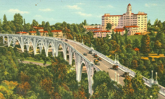 |
Arroyo-Seco Bridge: Recent View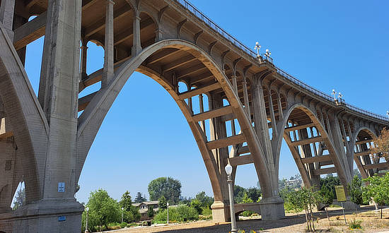 |
Best-Selling Route 66 Books and Maps at our Amazon Store |
|
| Route 66 Travel Guide - 202 Amazing Places by Mark Watson  |
Route 66 Full-throttle Adventure Handbook, by Drew Knowles  |
| EZ66 Guide for Travelers (5th Edition) by Jerry McClanahan  |
Rand McNally 2026 Road Atlas Large Scale Spiral Bound  |
About These ProductsThe Route 66 Road Trip website is a participant in the Amazon Services LLC Associates Program, an affiliate advertising program designed to provide a means for sites to earn fees by advertising and linking to Amazon.com and affiliated sites. Amazon offers a commission on products sold through their affiliate links. There is no additional cost to you. |
|
